In the past weeks, we have focused on the challenges of reconstructing the ancient landscape and patterns of past land usage. For our purposes, a crucial part of this is understanding the character of the Early Bronze Age Nile—after all, it was not without reason that classical authors like Herodotus described Egypt as a “Gift of the River.” The Nile’s regular flooding made for some of the most consistent agricultural surpluses in the ancient world, but as we discussed before, the character of the river itself has changed dramatically over time. Today we will begin a three part series on modelling Nile floods, starting with a discussion of the river itself. Next week, we will discuss Nilometers and archaeological sources for measuring flood levels. Finally, in the third part of our series, I will show some of the ways we can visualize this data within our GIS itself.
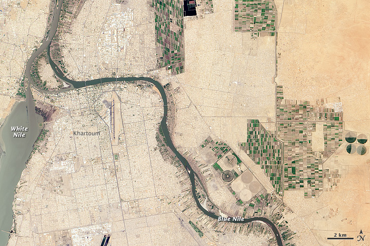
We will begin by reviewing some basic information about the Nile. As most know, it is the longest river in the world, though rising sea levels in the Mediterranean actually mean that the river gets incrementally shorter each year! The Nile is comprised of two distinct branches that meet near the Sudanese capital of Khartoum, and extend as a single river all the way to the Mediterranean Sea. The White Nile begins at Lake Victoria, and is named for the color of clay sediments carried downstream by the river. Its counterpart is the Blue Nile, which flows northward from Lake Tana in central Ethiopia. The pronounced difference in color visible in this satellite image helps show how these rivers got their names!
The Nile’s fluctuating flood level is largely determined by summer monsoon rains in the Ethiopian highlands that feed the Blue Nile. Indeed, this river supplies around 80% of the Nile’s total water volume during the inundation season! There is little reason to think that this pattern was substantially different even as far back as 4000 BCE (though as we will explore in future posts, the Sahara desert itself was substantially greener until roughly 3000 BCE). The Nile extends northwards towards the Mediterranean sea, carrying with it nutrient rich sediments that it deposits atop the floodplain during each inundation season. At certain points during its journey northwards, rocky cataracts make river transit more challenging. Our study examines the area near the most northerly stretch of rapids, near Aswan. As it approaches the sea, the Nile fans outward to the east and west at Cairo—in the ancient past, at least seven branches of the river extended to the Mediterranean.
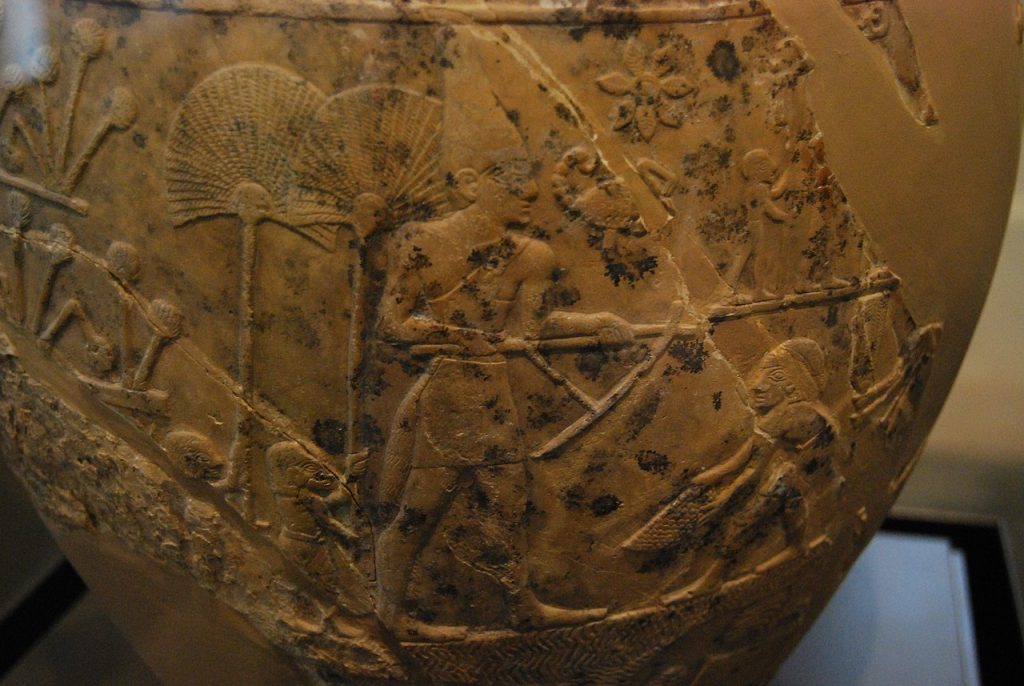
Compared to say, the Euphrates or Tigris in Mesopotamia, the Nile’s floods were gentler and more consistent—ideal for farming. Compared to their contemporaries in Sumer and Akkad, Egyptian farmers depended far less upon massive irrigation efforts, though there is certainly pictorial evidence for such projects even before the unification of Upper and Lower Egypt, as shown below on the Scorpion Macehead.
Each year, the Nile began to flood in June, slowly growing until it stabilized somewhat in August, until a final surge led to a maximum height in September/October. If the rhythms of daily life in Egypt were conditioned by the rising and setting of the sun, the Nile’s flooding and receding determined the administrative calendar. Officials divided the year into three seasons of 4 months, and their names relate rather obviously to the Nile and agriculture: Akhet (Inundation), Peret (Growing, or more literally, “coming forth”), and Shemu (Harvest). Usually, there was about a 7-8 m difference between the river level during the dry season and its maximum height during the flood. This meant that substantially more of the river was navigable during the late summer when most arable land was submerged. Prevailing winds from the north and the Nile’s relatively gentle course meant that travel was feasible both upstream and downstream.
It is difficult to overstate the effects of the inundation and the Nile more broadly on life in Pharaonic Egypt. Not only did the river create the conditions for floodplain farming, but trade shipped by boat along the river was approximately five times cheaper than overland transport (at least to judge from later Roman sources). From the First Cataract to the Mediterranean, there were few obstacles to riverine travel, though sailing would be more challenging during the dry season. Goods and people could be moved from Aswan to the Mediterranean quickly, and the ease of travel and transport by river doubtless facilitated trade and social interactions across a wider area than would have been possible otherwise. Ships played integral roles in religious festivals and royal iconography from the Predynastic period onwards, and allowed elites to elaborately stage their power in controlled settings. It is no accident that boats sometimes appear in rock art drawings far away from the Nile valley itself!
For the early Pharaonic state, the river was a powerful tool. In a premodern world where it was difficult to project power, the Nile allowed would-be kings to travel relatively quickly across their realm. Perhaps more to the point, they could be joined in these endeavors by an army. In fact, terminology related to naval titles are present in the organization of construction crews laboring on Old Kingdom pyramids! This brings us to a final point: the flooding of farmland during much of the summer likely created conditions where the state could extract a labor tax, or corvée, from its subjects. Farmers had comparatively little do during the precise moments when it was easiest to transport them for commercial expeditions, military campaigns, or construction work. By the Early Dynastic Period, such conscription would have been facilitated by the environmentally circumscribed environment—the inhospitable deserts beyond the Nile Valley made it harder to run away, though there is every reason to suspect that nomadic or semi-nomadic groups continued to live in or passed through these lands.
Certainly, the significance of the flood for agriculture was not lost upon the ancient Egyptians, and we have measurements describing the flood level in some of the earliest historical annals. Since at least the Old Kingdom, the height of the Nile was recorded at measuring stations that historians, Egyptologists, and archaeologists call “Nilometers.” In general, these are the principle sources we have for determining relative and absolute Nile heights before the invention of modern water gauges. Ancient, Medieval, and Early Modern annals sometimes record measurements from these installations, and are invaluable sources for determining flood levels. At specific Nilometers, one can even get a sense of absolute measurements in terms of meters above sea level. At sites like Elephantine, Roda, and Luxor, scholars from the distant past recorded their observations of the flood level. Next week, we will cover these measurements in greater detail.